Tecolote, you can't imagine!
F hdr.jpg)
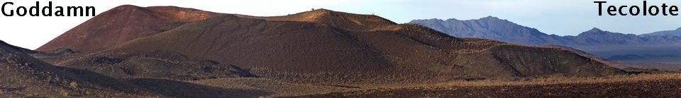
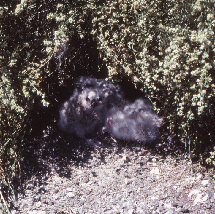
Tecolote masquerades as an ordinary cinder cone when you see it from the south on the Elegante road that runs along its lava flows. Its slopes show no erosion and its rocks are sharp, not weathered, but they have a well-developed desert varnish. The name "Tecolote," the Nahuat'l word for owl, came from these chicks I found on the cone in 1973. The Ar-39/40 age is 27 ± 6 thousand years (Guttman, et al., 2000).
Tecolote has a "coat of many colors;" black basalt, gray cinder, velvet-brown desert varnish, and the tan-yellow-red stains from fumaroles - it is a volcano that is anything but ordinary. More than 50 Ha of cone slope is covered with a layer of gigantic bombs. The cone is riven by faults and has three valleys that look like they collapsed into caves. Only shrinkage of the cone from internal melting could have made these unique valleys and faults but the mechanism is damnably obscure. Few cinder cones have more than one or two lava flows - Tecolote has seven.
Site topography
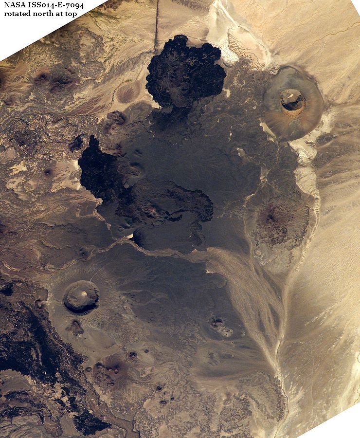
This image from the space station shows Tecolote between two of the giant maar craters. It was built on a flat plain that slopes gently southeastward about 5 m/km, the direction its lava flowed. Several older eruptive centers poke out of this plain including two average size volcanoes within 2 km of Tecolote. Deeply eroded Cone of Old to the west is a remnant, its walls reduced and lava flows buried. Mayo to the north is not much older than Tecolote, its lavas are still sharp enough that finding where Tecolote's Q contacts the Mayo flow on the ground is damnably difficult.sFw.jpg)
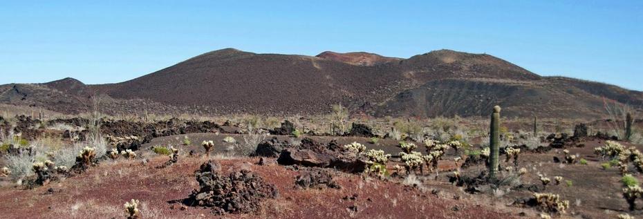
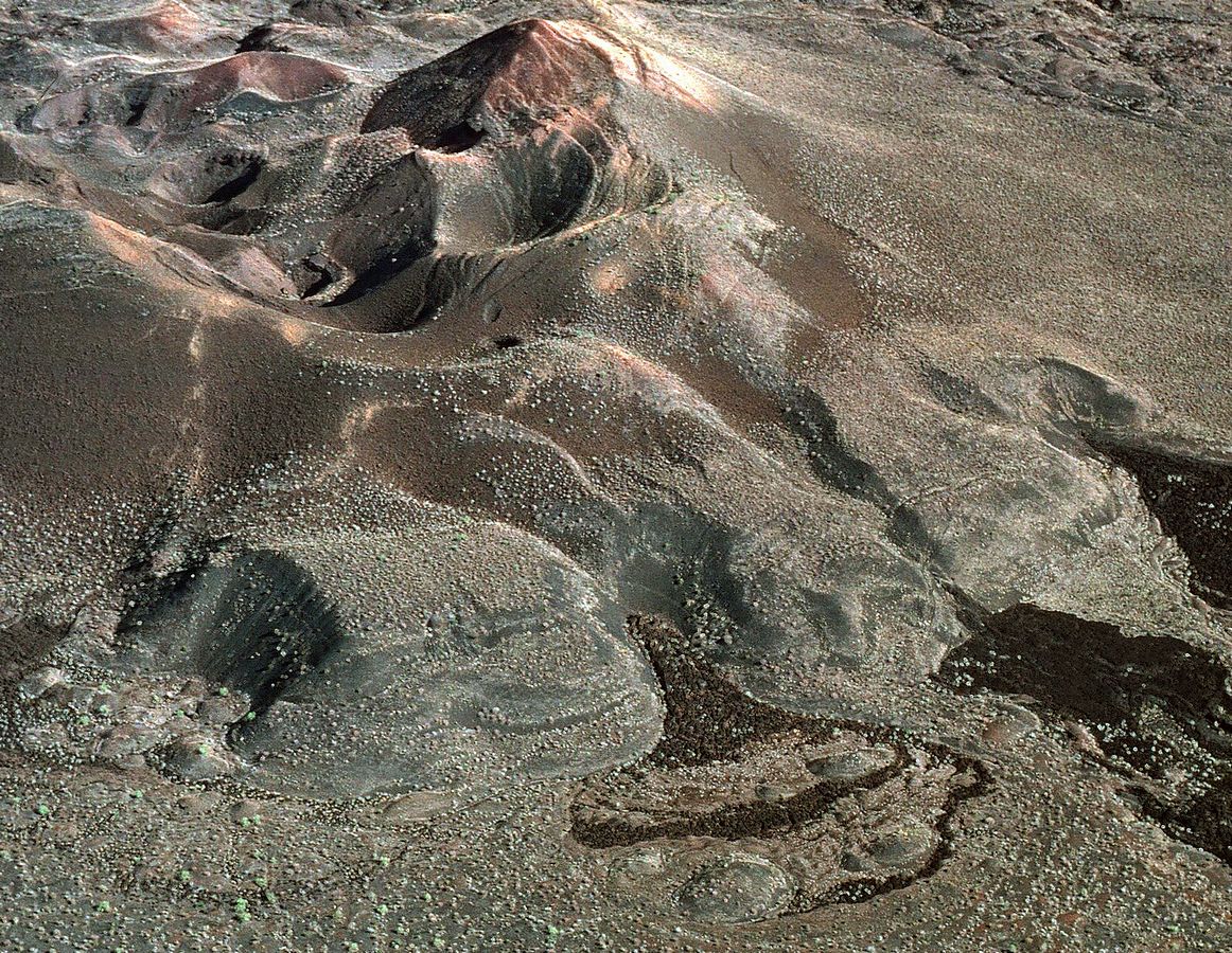
Tecolote cone has three parts
with separate histories; the older "Cinder Block" in the foreground, a large U-shaped half-cone behind it, and a hummocky mess on the left that I call the Collapsed Northwest Ridge because it appears to have fallen apart during the eruption. The main cone and collapsed ridge are sliced by dozens of faults, none of which extend into the Cinder Block. The Block contains the boccas of three short lava flows and is somehow involved with the large S flow to the south.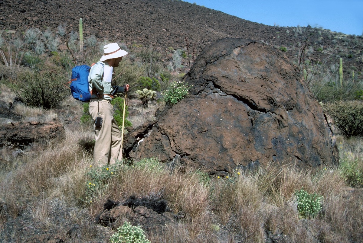
The bombs are more than impressive ...
Bombs have distinctive shapes; some are loaf-shaped (spheroidal), some stretched at the ends into spindles, others stretched longitudinally with skins like pulled taffy. Having a shape implies that they started out as blobs of liquid whereas retaining that shape on impact implies that each blob cooled enough in flight to behave as brittle material. (some shattered, some have dings) Imagine that for multi-ton masses.Some bomb skins appear smooth but have a microscopic roughness that took on a distinctive desert varnish that is as obvious in photographs as on the ground. A few have a large scale roughness called "cauliflower."
... and the cone shrank.
Three lava flows emerged from the south face of the Cinder Block and uphill from each one is a valley, two of those valleys cut into the cone behind. Subsidence into a void beneath is the only possible explanation for the valleys. The ridge in the middle top is cut by a set of sub-parallel faults and the sense of motion is clear - up is down as the ridge crest subsided into a graben. This ridge is the most extensively altered part of Tecolote, the scoria so tightly indurated that it is still standing in vertical walls after 27,000 years.Fw.jpg)
Seven Lava flows?
Tecolote is surrounded by seven bodies of basalt that I have mapped as independent lava flows. Two of them, Q and S, cover nearly 9 sq km of desert and are so extensively blanketed with cinder, the cone can be approached with ease from nearly any direction. Q, the largest, carried away the north cone wall and piles of scoria from that wall litter its surface out almost to its distal end 4.5 km from the bocca. The five smaller flow units that came out atop these larger flows lack airfall cinder and must be later. Although lava surface types range from runny pahoehoe on the B flow to very viscous squeeze-plate anosma on the A and R flows, they are probably nearly contemporaneous.
Cinder
NEEDS MORE is a puzzling component of this volcano. A distinct cinder blanket with a clear, albeit diffuse outer boundary covers the desert around Tecolote in this NASA image. Distribution appears remarkably uniform although the volcano is not centered in the oval field. Cinder pits dug by hand adjacent to the lava flows show at least 2 m thickness close in.Cinder nearly completely covers the S (South) flow and forms a band across the middle of the Q (North) flow, most certainly from a late stage cinder event. Cinder is conspicuously absent from the adjacent Mayo flow that predates the Tecolote event.