Geologic and geographic setting
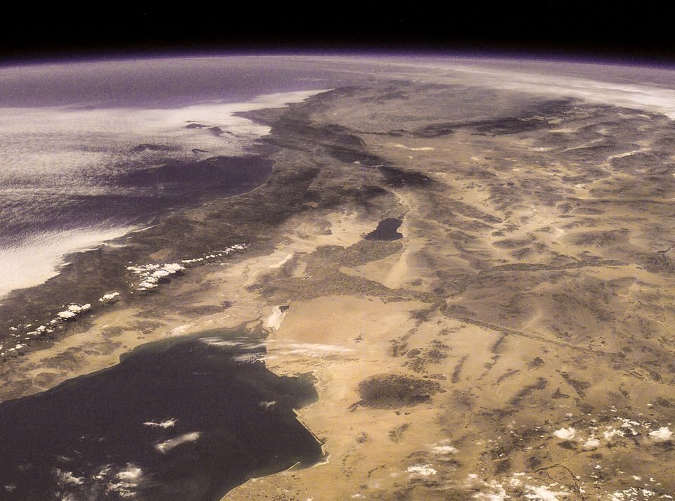
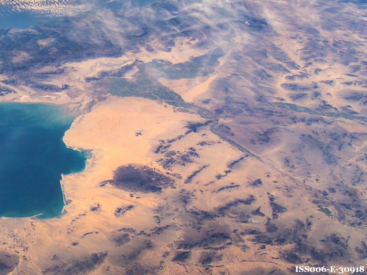
Pinacate’s black basalt stands out in sharp contrast with tan sand of the Gran Desierto de Altar north of the Gulf of California, a visual landmark recognizable from a great distance in space.
This land has political and cultural geographies in addition to its place on the Earth.
Locally, it “belongs” to the towns of Sonoyta and Puerto Penasco.
Some of the land also belongs to “the people” as ejidos.
Pinacate and adjacent Gran Desierto de Altar are a protected Biosphere Reserve (Mexican equivalent to a national park) that was established in 1993; and it became a UNESCO World Heritage Site in 2013.
The most intrusive political line is the border of a terrified United States that started as a line in the sand, graduated to a cattle-controlling barbed wire fence, and is now either a 3-m wall or steel barricade patrolled by men with guns.
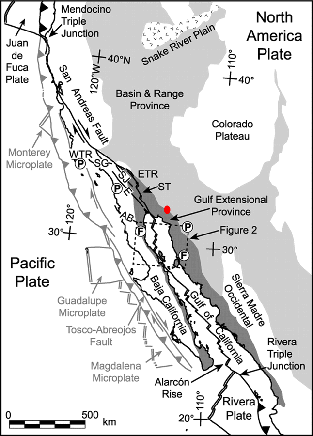
Most of the volcanoes are in Sonora, a few in Arizona, and all are in the Lower Sonoran Desert.
Trans-Mexico Highway 2 crosses the northern end of the field and Highway 8 between Rocky Point and Sonoyta near Organ Pipe Cactus National Monument passes to the east.
In this header, the light blue line surrounds the Gila-Pinacate Triangle study area and the purple line is the San Andreas fault plate boundary (explained below).
Cultural Geography
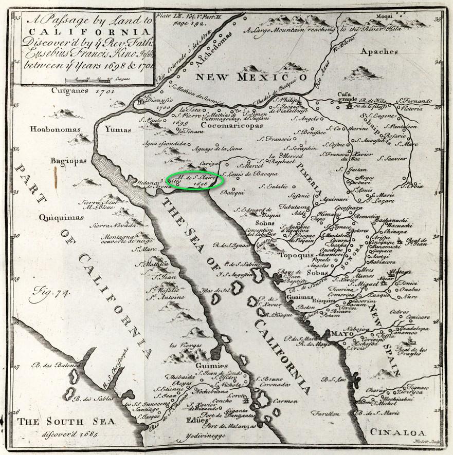
Hia C’ed O’odham, Pinacate’s indigenous people, survived in the arid desert for millennia, their stories only survive in oral tradition. Fr. Eusebio Francisco Kino and his Jesuit companions brought the European practices of journal writing and paper maps to Pimaria Alta in 1698. He put Pinacate on the map under the name “Santa Clara.” A century and a half later in 1854, the expanding United States acquired the Gadsden Purchase from Mexico, a strip of land intended for a Slave States railroad. Surveyors and scientists of the U.S. Border Commission marked the new line, made the first detailed maps of the area’s mountains, and began to catalog the rocks, animals, and plants. Their 1857 report contains the first recorded use of the name “Pinacate.” Serious exploration of Pinacate began in the early 1900s with the Hornaday expedition of 1907, the earliest scientific paper by Ygnacio Bonillas in 1910, and the explorations of Carl Lumholz in 1912.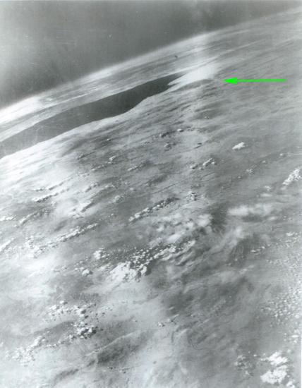
Technical Geography: Pinacate from space
THIS IS A STUBGoogle Earth is an embarrassment of riches with orthogonal (optic axis vertical) images having resolutions exceeding 1 m, excellent for geologic mapping. This website and much of my continuing work in Pinacate is dependent on that. Images from space have only been useful for the past dozen years. Lots of pictures, few good enough for science. Here is a historical selection of photographs starting with this second space image of Earth made from a captured German V-2 rocket launched over White Sands in New Mexico in 1947. Even as rocketry became a national obsession during the Cold War and NASA launched Apollo, Skylab, the Space Shuttle, and the International Space station, photos were made on film and most were snapshots. Many of the early film images of Pinacate have not yet been scanned to a digital format.
Physical Geography in pictures
This section is in active development. I am showing and explaining the desert around Pinacate in pictures and short captions. I only have a few as of today and it really doesn't make much sense. Come back tomorrow.